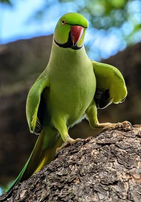
Public reminded to participate in online survey to combat invasive
rose-ringed parakeets on Kaua‘i
The Office of Economic Development is reminding residents, local businesses and visitors to participate in the citizen science mapping initiative aimed at addressing the growing concern of invasive rose-ringed parakeets on Kaua‘i. This tool, created by the Kaua‘i Rose-Ringed Parakeet Working Group, invites the local community and visitors to track and gather location data on these avian pests.
This initiative continues to monitor bird sightings and inform population management measures to curb the spread of this invasive species, which threatens Kaua‘i’s agriculture and delicate ecological balance.
Since the survey began in January, over 170 responses have been collected. Among these, 54% of respondents reported observing birds in flight, while 18% observed birds roosting. Additionally, the majority of sightings were reported in areas between Hanalei and Kalāheo. Survey data has informed management actions, leading to the culling of over 2,000 parakeets in Wailua and Līhu‘e.
Key features of the citizen science mapping tool include:
- User-Friendly Interface: The mapping tool is designed to be accessible for users of all ages, allowing residents and enthusiasts to contribute data effortlessly.
- Real-Time Reporting: Participants can report sightings of the invasive birds in real-time, providing crucial information to scientists, conservationists, and local authorities.
“This community science mapping effort has been instrumental in helping us identify high-activity areas, enabling us to plan and execute targeted culling efforts effectively,” said Nalani Brun, Director of the Office of Economic Development. “We hope that our community will continue to engage with the online survey, ensuring that community-driven data remains up to date. This ongoing participation will enhance our ability to address the invasive population and protect Kaua‘i’s ecosystems and economy. We thank all of you in advance for helping us help ourselves.”
Residents, local businesses, and visitors interested in participating in the citizen science mapping initiative can visit https://arcg.is/zHaTH0 or scan the QR code below to access the tool and begin mapping their observations.
For more information, please contact OED’s Agriculture Specialist, Niki Kunioka-Volz, at 808-241-4951 or [email protected].

